Pastoral farming contributes 46% of GDP and is key to food and social security in LAC. Tools that improve their efficiency are needed to increase their profitability and sustainability.
Remote sensors allow monitoring large areas and have information in almost real time


"The profitability and efficiency of pastoral livestock systems depends largely on making management decisions based on the quantity and quality of forage. "— Beukes et al. 2019 (doi:10.1071/AN17166)
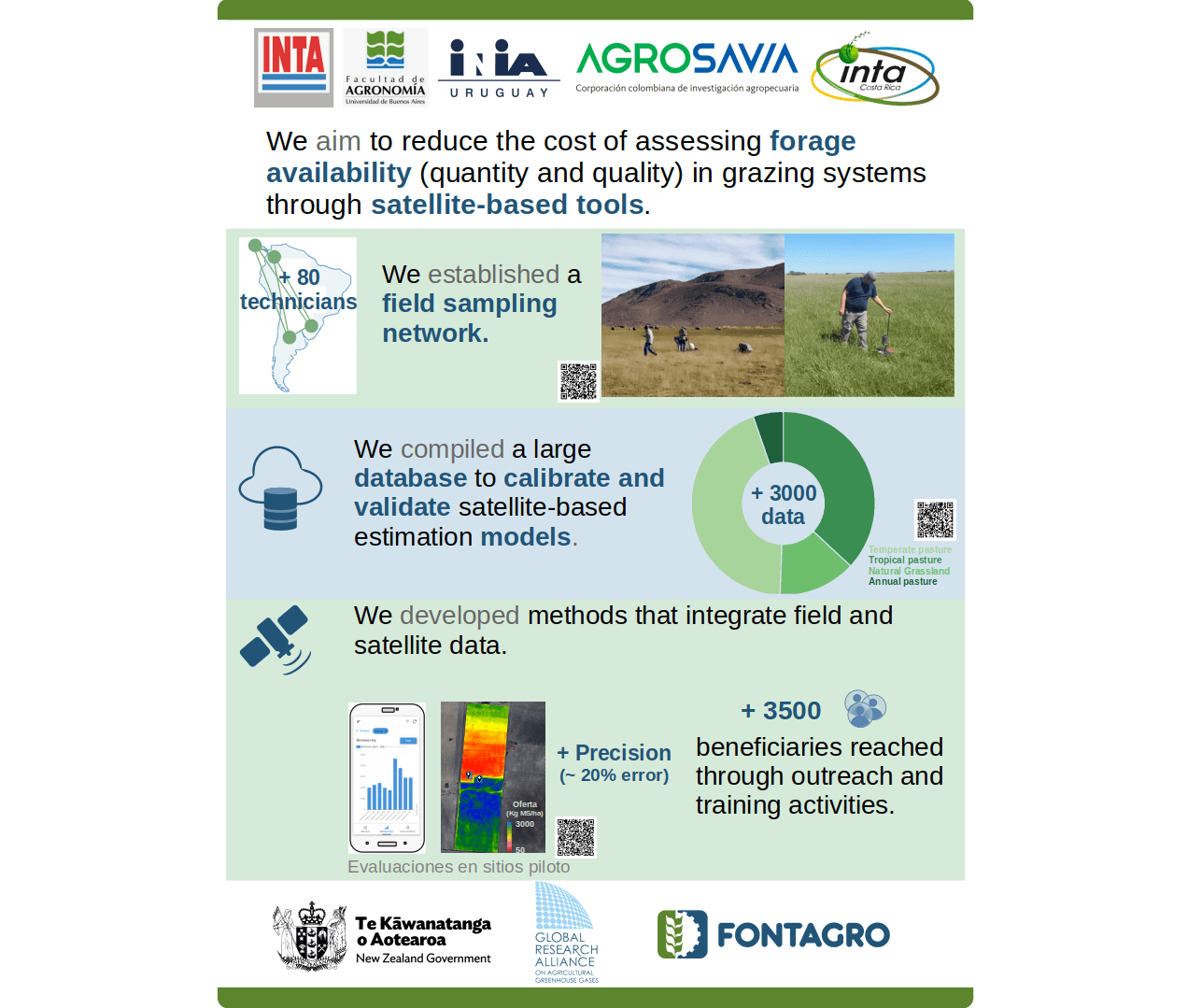
A regional monitoring network was consolidated across Argentina, Colombia, Costa Rica, and Uruguay, resulting in an open-access metadata database containing approximately 3,600 records (1,600 collected directly under a standardized protocol and 2,000 obtained through indirect methods), integrated within an automated digital workflow. Using these data, Sentinel-based machine learning models (Random Forest) were evaluated. The relationship between biomass and satellite-derived variables exhibited strong spatial and temporal variability, resulting in paddock-scale prediction errors (RMSE) of 820 and 612 kg DM/ha (~41% and 32%) when considering all forage resources and temperate pastures in Balcarce, respectively. In contrast, the relationship with forage quality (crude protein content) proved to be more consistent and generalizable. These advances supported the development of two simplification tools that integrate satellite and field data. The first is a spatial simplification approach that optimizes sampling through measurements at strategically selected locations corresponding to extreme spectral index values. The second is a temporal simplification approach that estimates real-time forage stocks by integrating residual biomass measurements with forage growth models. Both tools were validated under real farming conditions, achieving operational errors of approximately 20%, and contribute to sustainable livestock management based on scientific evidence. Dissemination and training activities reached more than 3,500 participants.
Relevant data


Argentina

Costa Rica

Argentina

Uruguay

Colombia


The Tangible Impact of Science and Technology in the Field


