This project works on multifunctional landscapes by simultaneously promoting agricultural productivity and environmental restoration. We will use satellite information, modelling and communication strategies for a sustainable transition
A pathway to sustainable production models through biodiversity integration and conservation
In recent decades, the Pampas biome has undergone significant land-use changes, resulting in the displacement of natural environments and highlighting the critical importance of biodiversity conservation. This project focuses on Uruguay and Argentina, two countries that share similar production systems as well as common challenges in rural development and sociocultural contexts. Our goal is to promote the transformation of homogeneous production systems into multifunctional landscapes that generate long-term environmental, social, and economic benefits.
With the support of FONTAGRO, we are consolidating a multidisciplinary platform that brings together experts from Argentina (Universidad Nacional de Río Negro) and Uruguay (SARAS, CEUTA) to analyze, generate, and apply knowledge in productive systems across the Pampas biome. The initiative is further strengthened through collaboration with producer groups, national research institutions, and organizations that promote family farming.

The proposed solution addresses the lack of predictability in agricultural management through three complementary technical components:
Hybrid Data Integration: Combines more than 285 yield maps generated through precision agriculture with landscape metrics derived from MapBiomas, enabling the systematic quantification of how proximity to natural habitats influences agricultural productivity.
Intelligent Modeling: Employs Machine Learning algorithms (Random Forest and VSURF) that integrate Sentinel satellite imagery, climatic variables, and private farm management records (SIMA) to generate predictive models of crop yields and pest pressure.
Landscape Redesign Protocols: Promotes the implementation of multifunctional landscapes through the establishment of biological corridors and cover crops, enhancing ecosystem services and productive sustainability.
"Multifunctional landscapes seek to complement or replace external inputs with ecological processes, thereby generating higher economic returns and increasing key environmental services"— Project team
The project has translated scientific evidence and large-scale data into operational management tools. We consolidated a geospatial database containing 4 million records, achieving an unprecedented integration of yield maps and landscape metrics. Through Machine Learning approaches, we developed models capable of explaining more than 80% of the variation in soybean yield, enabling accurate predictions of the effects of landscape configuration on agricultural productivity.
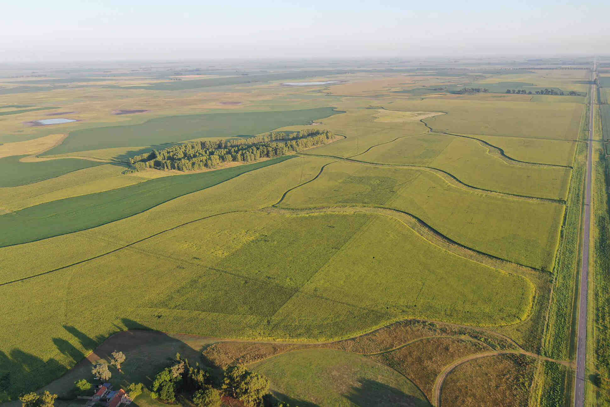
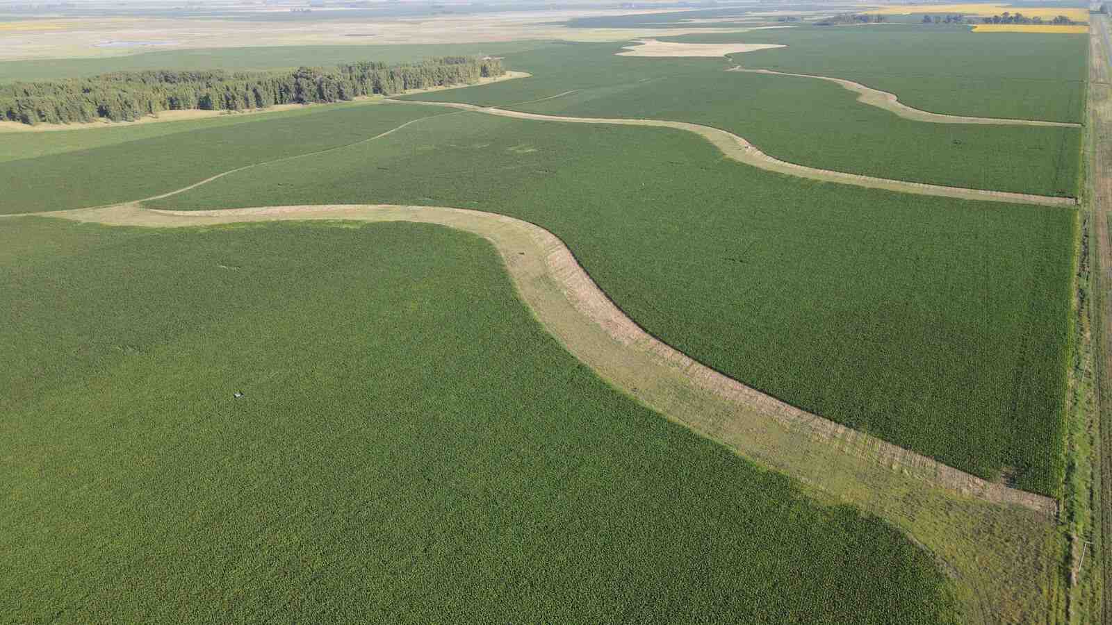
At the field level, landscape redesign has become a tangible reality. In farms such as Monte Hermoso, the implementation of biological corridors and the monitoring of 16,000 insect specimens have confirmed measurable increases in the functional diversity of pollinators and natural enemies. At the institutional level, ongoing efforts to establish the Permanent Landscape-Scale Research Platform (PPIEP) in collaboration with the Food and Agriculture Organization of the United Nations (FAO), together with the incorporation of these approaches into the ITSSA, are creating the conditions for translating scientific advances into public policies that support resilient agricultural systems.


Argentina
Uruguay

Uruguay
The Tangible Impact of Science and Technology in the Field


.png&w=750&q=75)
.png&w=750&q=75)
.png&w=750&q=75)