In order to generate a robust database to calibrate models for estimating the quantity and quality of forage based on satellite data, field measurements of biomass and forage quality began.

After a series of workshops to discuss sampling methodology and the development of digital tools to streamline sampling, field measurements began in over ten locations, with plans to continue incorporating sites. The objective is to generate a robust database to calibrate models for estimating both the quantity and quality of forage based on satellite data.
Between October 2023 and April 2024, the following activities were conducted: a workshop among technical leaders from the four participating countries (Argentina, Uruguay, Colombia, and Costa Rica), a workshop for the technical groups that will form the sampling networks in each country, field visits to three locations in Argentina where sampling began, and two outreach workshops on an application for classifying environments. This application, within the framework of the Fontagro project, is used for selecting sampling sites, although it can be used for other purposes in decision-making for productive systems, hence the workshops were attended by both technicians and producers. The application is available here and includes an explanatory video.
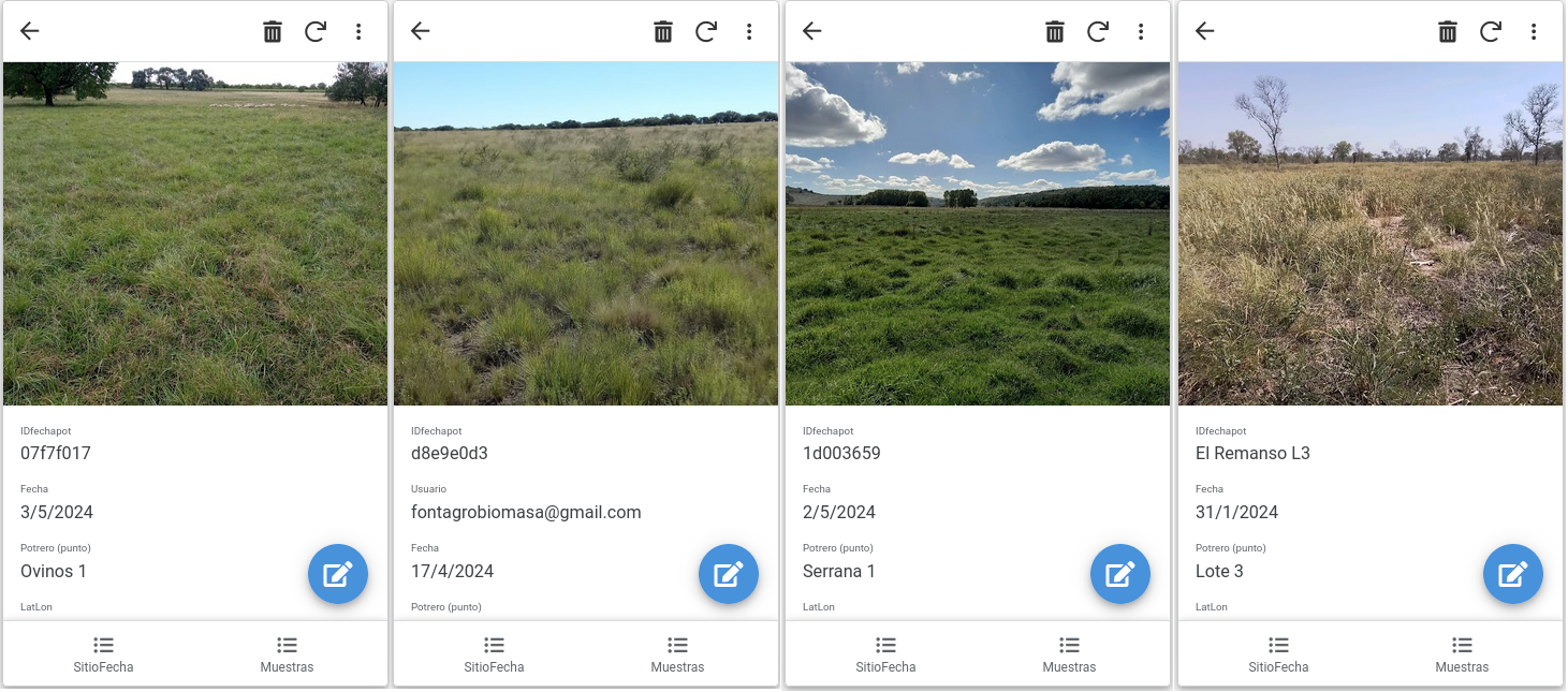
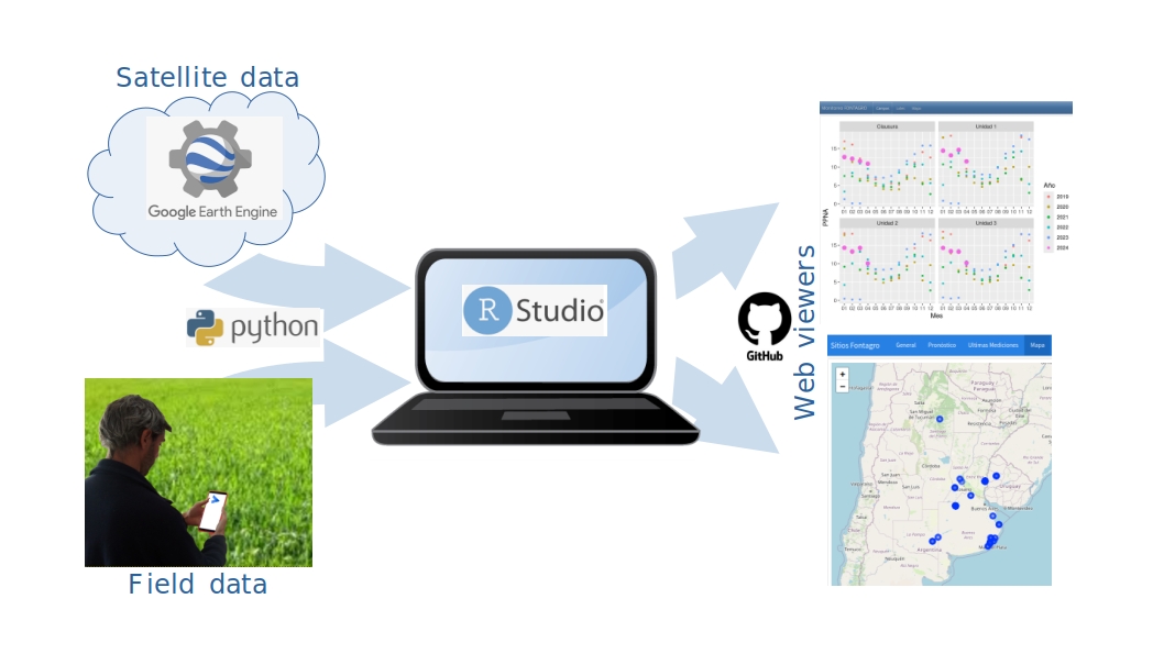
The sampling network includes a system that facilitates data recording and allows visualization of both field data and satellite data from sampling sites. The workflow involves data recording in a mobile application developed in AppSheet. Each field biomass and forage quality record is accompanied by its spatial location, photos, and other metadata, and stored in the cloud. Additionally, monitored fields are digitized to access satellite data available on Google Earth Engine. Using Python routines, cloud data is downloaded to a local server and processed in Rstudio, generating a visual interface in .html format. Subsequently, this file is hosted on a Github repository allowing data visualization from the internet. Currently, there is a page to visualize field sampling metadata and pages for various monitored fields where real-time satellite data can be accessed. As biomass and forage quality estimation models are developed from satellite data (over the next two years of the project), the models will be implemented on these pages to validate the technology.